
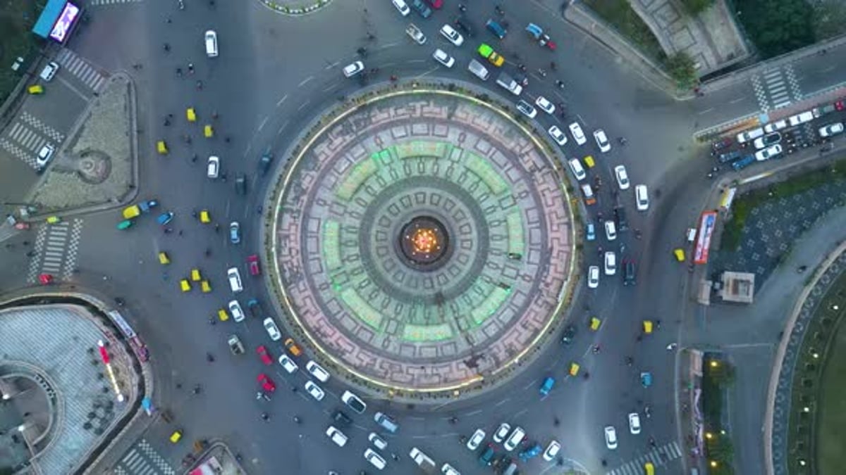
The Inconsistent Street: Six Lanes of Optimism, Two Lanes of Truth
Somewhere on the 1090 corridor there is a moment every Lucknow driver knows intimately. The road is six lanes wide, freshly divided, practically humming with ambition. You accelerate. You believe. And then, without warning or apology, the six lanes become two, a junction appears that nobody resolved, and three hundred vehicles perform an improvised merger that would bankrupt any airline that tried it.
We treat this as traffic. It is not traffic. It is geometry confessing.
A road that changes width randomly is not a road with a maintenance problem. It is a road with a biography. Each width is a different decade, a different agency, a different budget line, a different land acquisition that did or did not happen. What looks like a single road is actually a negotiated ceasefire between projects that never spoke to each other, with the driver left to absorb, in real time, the traffic fleeing the arterial that choked. A six-lane stretch feeds into a two-lane stretch because the six lanes were a project and the two lanes were somebody else's project, and the junction between them was nobody's project at all. The result is a network where every road tries to be every road, which is another way of saying no road works as any road.
There is a beautiful phrase in the UK's Manual for Streets that planners use: every street is both a Link and a Place. A link moves you through; a place invites you to stay. The design failure is not choosing wrongly between them. It is refusing to choose at all, which is Lucknow's signature move. We build link-width roads and then let them fill with place-type activity, then respond by widening the link, which attracts more activity, and the loop continues until someone proposes a flyover, our city's answer to most questions, including some that were not about roads.
THE JUNCTION PROBLEM, OR: WHERE OPTIMISM GOES TO IDLE
Watch what happens where the widths change. Six lanes of vehicles arriving at a two-lane throat do not disappear; they queue, they weave, they spill into the wrong side, and the junction becomes the city's real speed, no matter what the wide sections advertise. Traffic engineers have a dry phrase for this: a network is only as fast as its most confused intersection. Widening the road between confused intersections is like buying a bigger funnel and keeping the same spout, then being surprised, annually, at the pouring speed.
This is why the lane-count lottery matters beyond irritation. It wastes the crores spent on the wide sections, whose capacity can never be used. It pushes impatient through-traffic into residential lanes, where children play. And it makes every journey time unpredictable, which quietly taxes everything: deliveries, ambulances, school buses, tempers.
WHAT GOOD PRACTICE LOOKS LIKE
Delhi's UTTIPEC street design guidelines did something quietly radical for an Indian megacity: they published a common standard, so that every agency touching a street was, at least on paper, drawing from the same rulebook: footpath widths, junction geometry, bus stop placement, the lot. Chennai went further and paired its street design manual with an empowered cell inside the corporation to enforce it, which is why its redesigned corridors feel like one hand made them. Internationally, the Link and Place framework has given cities from London to Auckland a simple discipline: classify every street, publish the classification, and design to it. None of this is expensive. All of it is boring. Good road networks are boring the way good accounting is boring, and for the same reason.
FIVE FIRST MOVES FOR LUCKNOW
- Map the network as it actually is. One honest map showing every width change, every unresolved junction, every road performing a role it was never designed for. The map will be embarrassing. Embarrassment is a renewable civic resource; let it fund the next step.
- Classify every road: arterial, collector, local. Publish it. Once a road has a declared job, every future decision about it, from hawking zones to signal timing, has a reference point other than negotiation.
- Fix throats before widening anything. A moratorium on adding lanes until the junctions at both ends of those lanes are resolved. Capacity lives at intersections, not between them.
- One shared street design manual, binding on LDA, Nagar Nigam, PWD, the Smart City SPV and the Metro's road restoration teams alike. Five agencies, one rulebook, and the two-lane-to-six-lane lottery loses its licence.
- Protect local streets on purpose. Once arterials do their job, neighbourhood lanes can be design-calmed, and streets where children play can stop moonlighting as bypasses.
THE ARGUMENT UNDERNEATH
A road network is really a promise about time: leave now, arrive then. Cities that keep the promise earn trust you can measure in property values, business decisions, and blood pressure. Cities that break it teach every citizen the same lesson daily: that the system is improvised, so improvise back. Much of our famous traffic indiscipline is not a character flaw. It is a rational response to infrastructure that behaves indisciplinedly first. People rarely respect a system more than the system respects itself.
And the quiet truth is that Lucknow already contains roads that know what they are. Walk the lanes of the old city: they are unapologetically local streets, and they work as exactly that, as they have for two centuries. The confusion is not in our bones. It is in our files.
Next week: traffic management that manages nothing, or why a signal is a promise too, and what happens to a city where nobody believes the lights.
This is the second essay in Fixing Lucknow, a weekly series on the urban design of our city and, by extension, of India's tier-2 cities. Essay 01, on walking, is on the blog. Disagreement is welcome; that is what the series is for. Write to mail@aplusud.in.
References: UTTIPEC Street Design Guidelines, Delhi Development Authority; Chennai Street Design Manual and the GCC street design cell, ITDP India documentation; Manual for Streets (UK Department for Transport), the Link and Place framework; Jones, Boujenko and Marshall, Link and Place: A Guide to Street Planning and Design; IRC codes on urban road classification (IRC 86, IRC 106).